Parcel-Level Insights
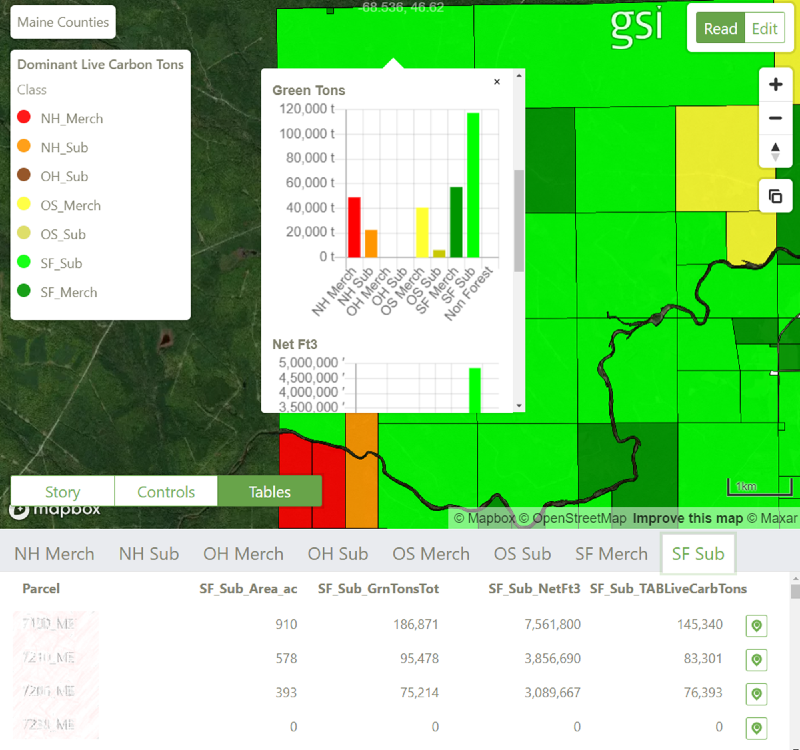
ForINT Northeast provides parcel-level insights across Maine, providing rapid search, assessment and comparison for the customer interested in acres and volume split by forest type:
- Species groups, including
- Northern Hardwood
- Spruce & Fir
- Timber size
- Merchantable
- Sub-merchantable
Standing volumes are available in a range of metrics including
- Green tons
- Merchantable timber
- Above ground carbon

Forest Stratification
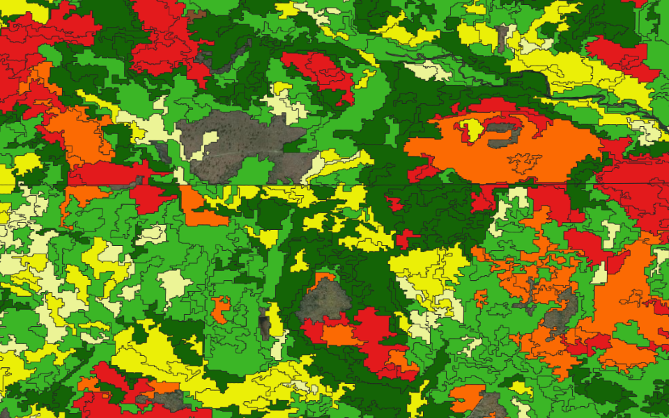
Forest stratification is provided as standard. The forest typing describes species, height, and density class.
Each forest stratum is supported with a comprehensive list of attributes derived from regional USFS FIA data. These include:
- Volume - standing volume, green tons, above ground carbon, merchantable timber
- Size - top height, basal area, QMD
- Density - trees per acre, stand density index
All Raster data of GSI’s analytics are available for the entire State of Maine. Contact us to inquire about including raster data with your ForINT purchase.

Included in ForINT Northeast are 2 vector polygon layers
- Detailed: 4 height classes, 6 species classes, 4 density classes
- Simplified: 4 species types, 2 height types
Each forested polygon has 30 attributes, including:
- Net volume
- Green tons
- Above ground live carbon tons
- Basal area
- Average height
- Quadratic mean diameter
- Stand density index
- Trees per acre
- Net board feet
Easily view and share your ForINT data through a browser-based portal to enable interpretation of data from multiple layers. Data is also available for download and utilization in existing GIS software for further processing.

