Use cases
Timberland acquisitions
Forest Carbon Origination Planning
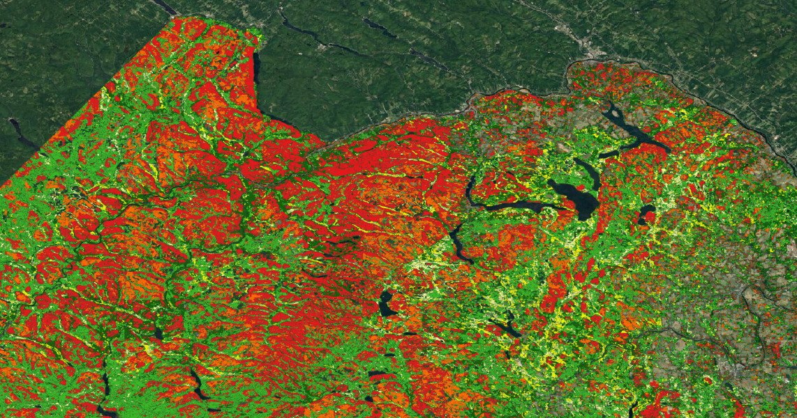
Stratification for forest inventory
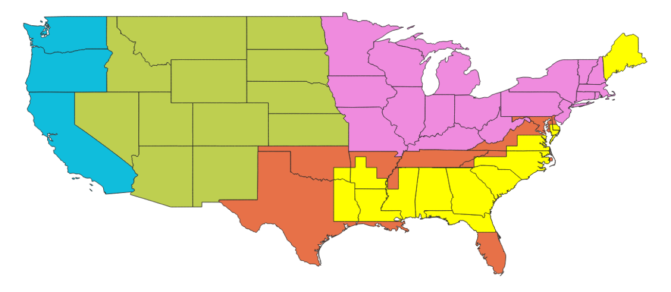
Regional Variation
The ForINT analytics varies by location to reflect the forest types and the needs of our customers.
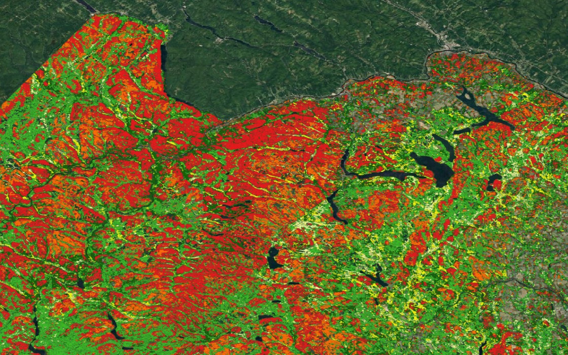
ForINT South
Evergreen plantation forestry dominates, and insights are built at the parcel-level from maps of clearfell and thinning activities. Currently available in - South Carolina, North Carolina, Georgia, Alabama, Mississippi, Louisiana, Arkansas, Texas, Virginia, Oklahoma, and Florida.
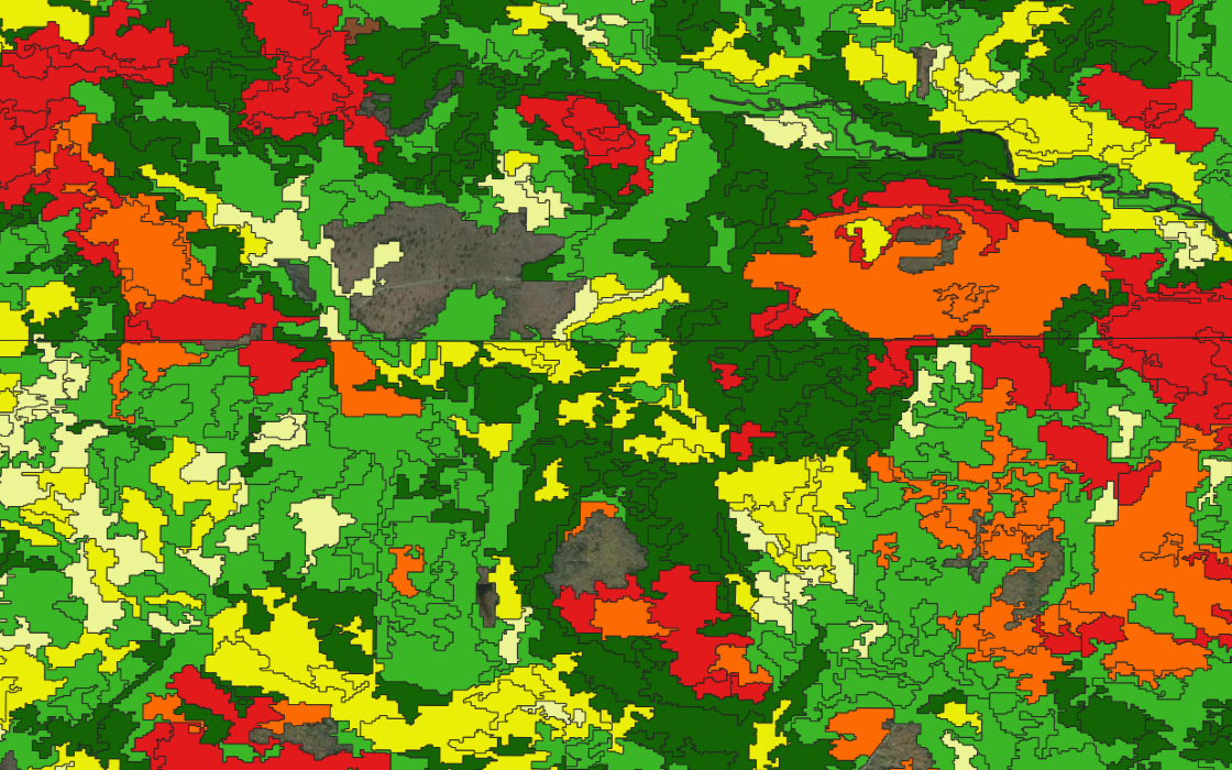
ForINT Northeast
Mixed age forestry dominates, and parcel-level summaries are provided with underlying stratified forest inventories. Initially available in Maine.
Need data for a different State? Get in touch via our contact page.
GSI’s approach combines artificial intelligence and supercomputing to build machine learning models that assess forests using a time series analysis, tracking subtle changes over time. We analyze many types of data to create the most accurate results, including satellite imagery, LiDAR, FIA plot data, and more. The result is wall-to-wall coverage of entire states, enabling decision-making informed by landscape-level trends.
Data can be purchased for an entire state or at the county and town level.
Need data for a different State? Get in touch via our contact page.